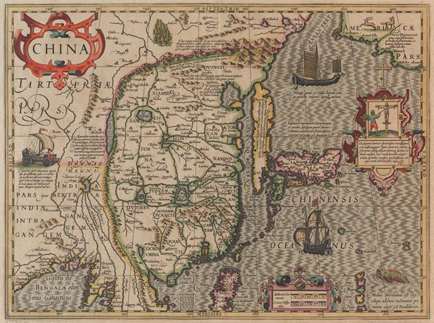
Map of China
1619
Besides being used for trade and travel, maps often carry ideological weight because geographic knowledge ultimately offers a means to control the world—to understand, describe, organize, navigate, and even exploit and conquer. This map focuses on China, Korea, and Japan and also includes the northern part of Luzon (today’s Philippines) and the Americas as if very close at upper right. Cartouches in Latin describe fantastical ideas about native cultures and technologies. Supposedly, the Chinese invented a wind-driven land chariot and the Japanese crucified criminals bound on a cross. In Europe, the golden age for the atlas began in the Netherlands and Italy, followed by German, French, and British cartographers. Naturally, Ottoman, Mughal, and Chinese mapmakers produced very different world views.
16 1/4 x 22 1/4 in. (41.28 x 56.52 cm)
Eugene Fuller Memorial Collection
48.127
Provenance: France; John Howell, Books, San Francisco, California; Seattle Art Museum, Seattle, Washington, Eugene Fuller Memorial Collection, May 29, 1948
Photo: Elizabeth Mann

